Friday, April 22, 2016

Total Station Topographical Field Survey

Introduction:

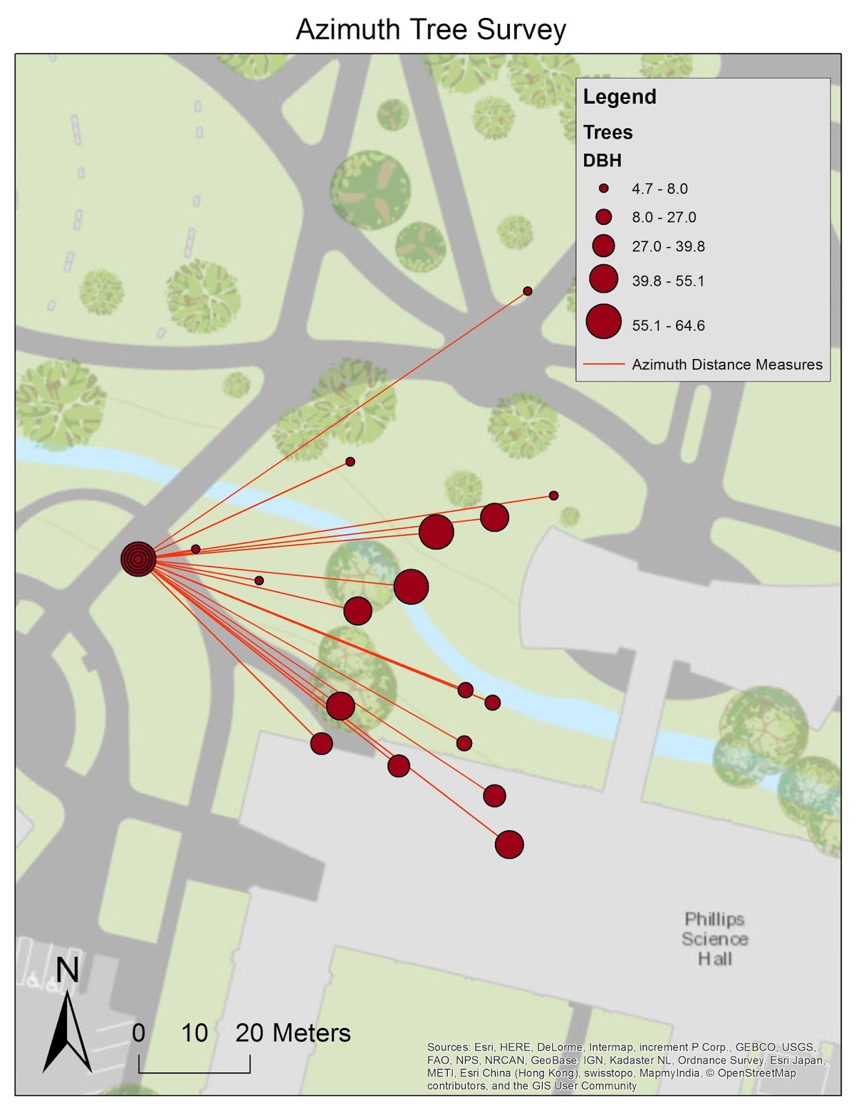
Previously we conducted a survey using the Distance/Azimuth Survey method , in which we used a laser measure to find the distance of objects relative to one central point on the UWEC campus mall.


During this survey, we are going to build upon the previous distance/azimuth method by using a Topcon Total Station and a Tesla GPS Unit. The differences between the two survey methods are as follows; first, with the Topcon Total Station, Due North has to be known in order to calibrate the Total Station, second, the topographical survey generated by using a total station will also assign a height measurement to each point collected. The height measurement may not seem like a lot, but it gives us another dimension to work with, as we then have measurements on the X,Y, and Z axis. As you may have seen in previous blog posts, the Z measurement will give us the capability to model the surface of any area surveyed in 3D using ArcScene. 


Fig 1. Dr Hupy explaining the setup of the Total Station, again this week it was raining and again we used the campus mall as our study area. It is important to note that the pink flag under the total station designated the occupied point, over which the total station was calibrated. The equipment listed from left to right is the Topcon Survey Grade GPS, the Total Station, and the Prism Pole
Study Area:

Similarly to most of our other surveys, the UWEC campus mall with its diverse topography, would serve as the study area for this survey. Specifically we set the total station on the lawn between the Davies Center and Phillips Hall, before the bridge cross Little Niagara Creek. 

Fig 2. The UWEC Lower Campus, and the location of the campus mall.
The survey area is a small section of lawn bisected by sidewalks that extend through the campus mall, and which lead up to the entrances of Phillips Hall. The area is on the south side of Little Niagara Creek, and is obstructed with young trees that have been planted as the campus mall has been rebuilt. The ground has an incline leading up to the West side of Phillips hall and a also features a decline as you near Little Niagara Creek (Fig 3).

Fig 3. The location of the Total Station Topographical Field Survey is the area of lawn in the lower right hand corner of the picture, near where the small tree is planted, and stretch to Little Niagara Creek. 


Methods:

The Total Station has a few additional setup and technology requirements in order to function. Rather than having a central point that may be slightly variable (due to human/procedural error) the total station has to be set on known benchmark, known as an occupied point. In addition to this occupied point, 2 or 3 back sites are required which are also known points and used to calibrate the total station. The back sites are calibrated using a secondary unit known as a Prism Pole, which reflects a laser shot by the total station and using triangulation with the Prism Pole, measures the height the height of the object being measured. It is VERY important to note that at no time can the Total Station be moved, adjusted, or bumped and that the Prism Pole's height must not be changed without recording the adjustment. Failing to note the adjustment or a disturbance of the Total Station will result in inaccuracy and error which will propagate as more points are surveyed.

Here is another resource from the UW-Madison as to how to set up a total station, and what individual components make up the whole unit. 


For written step by step directions to set op the Total Station please see Appendix A at the bottom of this post.  

After the total station is set up, every time a points is surveyed three different measurements are taken. 

  1. Angle measurement: taken in arc-seconds (theta, Fig 3)
  2. Distance measurement: via the reflection of the prism pole (D, Fig 3)
  3. Coordinate Measurement: the coordinate measurement of any point is determinedly using retaliative position of the distance measurement to the known point that the total station is over. Height measurements are then calculated using trigonometry and triangulation from the angle of the total station to the reflection of the prism pole.  


How these three measurements come together is pictured below (Fig 3). 


Fig 3. A representative picture of how Total Stations capture all two of the three measurements, angle (theta), distance (D). Not shown specifically is coordinate measurements, which is captured by linking the total station to the survey grade GPS unit, at which point the coordinates of surveyed points are estimated using the distance measurement relative to the known location of the total station, The level road is also not used in our analysis, but rather the prism rod which reflects the total stations beam back to the total station for digital measurements and calculations.


With the knowledge of how the total station is set up and the unit captures data points, one is now ready to proceed with a survey. In this case we will be doing a topographic survey, so data points of the local landscape will be to capture the numerical attributes of various points in the area. 

Fig 4. The total station set up and working, ready to capture survey points of the landscape. 

Fig 5. The view of the total station from the perspective of the prism rod.

Fig 6. A picture of the total station capturing a point via the prism rod. 
When using the Total Station all you have to do is look through the lens piece and line the cross hairs up on the prism, once the cross hairs are set on the prism, you hit the capture button on the GPS to capture the point. As the prism is moved to various points, this process is repeated until enough survey points are captured or the desired number of points are surveyed.

Results/discussion:

For our survey we collected 97 points on the UWEC campus mall, with both the known control point and the two back sites, a total of 100 points were collected (Fig 7).

Fig 7. The attribute table of all 100 survey points opened in ArcMap with X,Y and Z data recorded.
The Map below reiterates the specific survey location, showing both banks of Niagara Creek captured, as well as the various points on the campus mall surrounding Phillips Hall.  The known control point is shown on the map below (Fig 8) in yellow and labeled "OCC", this same point is depicted in Figure 1, as the pink flag under the Total Station. 

Fig 8. The survey points of the Topographical Survey are depicted by the purple circles while the known control point and the two back sites are depicted by the varying colored circles with different symbolism than the survey points. The Total Station was set up of the point OCC , with the survey grade GPS directly behind the site.
After the data was validated by point all of the survey points into ArcMap, and making sure that the points could be read by GIS software, the data was put into ArcScene for 3D rendering. In order to make the data points show more drastic height differences between the data points, a floating surface was created for the maps base height and a factor of 4 was used to differentiate the heights of the individual data points. With out these manipulations, the 3D image would have had very little variation in height and would have looked remarkable flat due how close the data was, in terms of elevation. In Fig 9, below, the green represents the lowest portion of the data, and would have been the data that was captured closest to Little Niagara Creek. While the white portions of the map, would be the highest points captured, on the left hand side, these points are in a garden near Phillips Hall.
Fig 9.  The 3D Rendering of all 100 data points, the lowest portion of the image (green), are areas that were recorded near Little Niagara Creek. The white area represent the highest points captured, which would have been near Phillips Hall (left side) and on the other side of the Little Niagara Creek bank (right side)


Fig 10.  Another 3D rendering of the data points, the 3 green pins in this image represent the known control point (standing) and the 2 back stations (flat). 

While the quality of the data that was collected with the total station was precise, some of the data was inaccurately represented in the map (Fig 8).  Which brings us back to the idea of accuracy and precision, and what those terms truly mean (Fig 11). The points that were recorded in using the Total Station were low in accuracy and high in precision, at least according to the points when overlaid with a base map of campus. What this means is that relative to each other, each point was placed correctly in terms of relative position, however some points were low in accuracy, appearing in the Little Niagara Creek, and in Phillips Hall.

Fig. 11 Accuracy vs. Precision. 
These errors may be attributed to potentially a few things

  1.  Human Error; either in the set up or in the import of the data or the calibration of the units.
  2. Error in the base map; which reports all points to be off by some measure across the board.
  3. Actual Error in the tools. 
More than likely, because we are dealing with a survey grade GPS that can be accurate down to the sub-meter level, the errors are not coming from the GPS and as the GPS is connected to the total station which uses quite a bit of technology to accurately measure distance, the error probably does not lie in the equipment.

Due to the fact that the points that are inside Phillips Hall are just barley on the outside edge of where the building is drawn, it may be that the scale at which the data points are represented and a combination of that data being projected or converted and/or an inaccurate base map, it would seem that these errors are procedural or a result of human error rather than error in the equipment. 


Conclusion:

While the Total Station survey technique may seem straightforward, it's really the culmination of multiple survey techniques that we have been building on over the course of the semester. From the Sandbox Survey we have taken the aspect of 3 dimensional measurements (X,Y, and Z). From the second survey, Data Interpolation in ArcScene, we included the aspects of proper survey procedure with have data normalization, data interpolation, and also included dimensional analysis and arc scene.  Then from the Distance/Azimuth Survey, we have core idea of all of the survey points being taken in reference to one standard base point. And finally we have the accuracy of the survey grade GPS from the Topographical Survey.  While the total station adds a new element of technology and a more systematic way of referencing survey points than we had previously explored in the Distance/Azimuth Survey, the methodology of the topographical survey contains elements we have seen before.  What the Total Station Topographical Field Survey adds is the combination of the survey grade GPS to enhanced accuracy and precision of the survey points in relation to the known control point and to capture many survey points in three dimensions.

This is why it is not a surprising that this survey technique is used in industry where accuracy and precision are required.  Potentially another way to include increased data normalization, is also something that we have worked with before, which would be to include capturing attribute data in addition to X, Y, and Z data through the use of domains to capture more information about each survey point, while constraining the data entry to relevant information.

Practical applications of adding attribute information via domains would include surveying points for road construction that have objects or obstructions which would need to be removed or built around in order to complete the project.


Appendix A:
Steps to collecting data with the TSS
  1. Set up Survey
    1. Outside set pin flags where you will set up the total station (Occupied Point and the BS point
  2. Set up Magnet Job
    1. Set up a job within Magnet using the RTK option. This is the same procedure as setting up the job for surveying with RTK GPS.
    2. Gather your backsight(s). Name them BS1, BS2, etc.
    3. Gather your OCC1 (This is your occupied point where the Total station will
  3. Set up the TSS
    1. Tripod Setup
      • Wipe off head to ensure that surface is clean and free of dirt
      • Extend all three legs equally prior to spreading the legs.  Secure locking Mechanism
      • Spread the legs sufficiently to ensure a stable base for the tripod
      • Center tripod head over the point while maintaining a fairly level tripod  head
      • Check centering by dropping pebble from the center of the tripod head. (within 2" of Pt)
      • Step down firmly on the footpads to set the legs
    2.  Instrument Setup
      • Secure instrument to tripod and center over tripod head
      • Bring all leveling screws to a neutral position, just below the line on the leveling screw post
      • While looking through optical plummet (if needed adjust o.p. for parallax and focus on the ground) or
      • with Laser plummet on, position instrument directly over point by using Leveling screws only.
      • Observe what two legs need to be adjusted to bring Bullseye bubble into the middle
      • Be careful not to move the third Leg
      • Release Horizontal tangent lock and rotate instrument until tubular level vial is parallel (in Line)  to 2 of the leveling screws.(this position 1)
      • Rotate both leveling screws equal amounts in opposing directions until tubular level vial is centered
      • Rotate instrument until tubular level vial is perpendicular to Position 1
      • Rotate leveling screw equal until tubular level vial is centered
      • Re-observe the point with o.p or laser plummet an adjust instrument over the point by loosening the center screw and shifting instrument over the point and re-tighten screw.
      • Re-check the fine(tubular) bubble vial in position 1 and 2 and adjust as needed
  4. Set up Blue Tooth
    1. Turn on the total station.
    2. Turn on the station Bluetooth. This is done within the menu area, and within the parameters portion.
    3. Make sure your Bluetooth is on for the Tesla to recognize it.
    4. Disconnect from the Hiper in your job, and now connect to the Total Station
  5. To begin the OCC/BS setup
    1. On the Home Screen for Magnet, select the Setup icon
    2. Click on the backsight icon
    3. Enter in all needed information for the TS and for the Prism rod.
    4. Place your prism rod over the backsight point and gather the backsight. This is needed to zero out the total station for north
  6. Collect GPS points with the Tesla in Magnet, using the Total Station and prism*
    1. From the Magnet Home screen, open the Survey icon.
    2. Begin your toposurvey, but now use the prism and total station to do the survey.  

Sunday, April 17, 2016

Topographic Survey

Introduction :
This week our task was to create a Topographic Survey of the UWEC campus using a survey grade GPS. at various points around campus, which would capture the make up of the campus grounds.


Study Area/Methods:
As per usual the study area was the UWEC campus grounds (Fig 1), which does have a large variety of terrain and geospatial features, such as the campus mall, which is a flood plain, the banks of the meandering Chippewa river (not pictured) and Little Niagara Creek which flows through the campus mall.   
Fig 1. The UWEC Lower Campus, and the study area of the Topographic Survey.

We deployed a survey grade GPS to capture points of the UWEC campus. The survey GPS we were using had two components a top receiver and a TESLA unit that is a mobile field tablet controller

Fig 2. The Topcon Survey Grade GPS and Tablet Receiver being explained by Dr. Hupy.


After turning on both components of the GPS, we began collecting points. We had to make sure that the points which we were collecting were fixed, and that the accuracy in both height and vertical distance was at a usable minimum, in this case, under one meter of variance.


Fig 3. The GPS Unit showing fixed position and height (H) and vertical distance (V) error estimates, as you can see both estimates come in under 1 meter.

Once an object was going to be surveyed, we would select the point type from a prearranged list of objects on the UWEC campus such as light posts, garbage cans, bus stops, etc.. This points can really be anything that one wants to survey, but obviously have to be applicable.

Fig 4. List of objects to choose from when surveying.
Once the object was established as our survey point, we set the survey grade GPS as close as possible to a point that we were trying to capture and input the type of object it was, and if the object was tree, we recorded the diameter at breast height (DBH) measurement of the trunk. We had the GPS capture a minimum of 20 points at that location, each having a slight variation in height and vertical distance variation as the GPS captured data. Then the GPS averaged all the variation in height and vertical distance that were measured into a final point that was reported. For increased accuracy one could have the GPS record more points.


After many points were captured we brought the data into ArcMap simply by taking the text file the data was reported in, and importing that to a table in a new geodatabase. From there we imported the points using the "Add XY data" tool on that table and then defining the fields of the table.


Results/Discussion:


Once the points were entered and uploaded to ArcMap, they were mapped with the results are listed below. In terms of representing the points, all of the points were in the correct position relative to the base map (Fig 5), with points appearing to be out of place like in the distance azimuth survey.

Fig 5. The UWEC Campus with all of the points surveyed displayed on a map showing the positions of points surveyed (green) in relation to the rest of campus.
Because this survey was capturing attribute data on different objects on campus a symbol map listing each one was appropriate (Fig 6). As a survey would gain complexity by increasing the size and scope of the project, a different tactic may need to be taken in representing all of the point attributes that are captured, such as grouping features for easier representation, which was not necessary here.
Fig 6. A closer extent of the points surveyed on near Phillips Hall, with colors indicating the object surveyed.
In an attempt to better represent the points different symbols were employed to try and bring a little more depth to the map/ make the map more appealing to the average viewer (Fig 7).
Fig 7. Getting fancy with the symbolism of the Topographical survey.
With a photograph of campus as a basemap, some of the points suffered from being undistinguished due to the contrast ratio between the colors in symbols and the tree coverage of campus (Fig 7). So a new base map, which turned out to be more updated with actual representations of the current buildings on campus was used instead. With out the tree coverage and the lack cars, the points of the survey are represented better.
Fig 8. In the above base image layer, I noticed that the representation of campus was outdated, so I searched for a new one. While not as pleasing as a photo, it is accurate to where the actual buildings on campus are.


Conclusions:

As compared to the distance azimuth survey which was relativistic in its point determination, the topographic survey with a survey grade GPS was excellent in its ability to capture data points accurately.  All of the points appear to extremely accurate and are not located in positions where they physically can not be, which is to be expected considering that each point was captured with a survey grade GPS 20 times and then averaged to create a single point. Due to the accuracy level of the equipment employed this topographical survey did a much better job of representing points on campus as compared to the distance/azimuth survey.

But realistically, the distance/azimuth survey is not for the same purpose as a topographical survey such as we have just done. A survey grade GPS is an expensive piece of equipment which is used in industry analysis, construction, and situations where accuracy truly matters. The distance azimuth survey is employed where very limited situation constraints exist and one needs to be more adaptive in their survey methods.

Another important note is that error and in accuracy can still occur when using expensive equipment. A survey grade GPS for example is accurate, but also evolves the skill of the user and that persons ability to under stand not to understand the equipment but the theory behind how that equipment gathers data to get the most out of the survey. While the only error that can occur in a survey like this is human error in either setting up the GPS or in integrating the points into ArcMap, the error can still be costly, and requires the human component to think through the process and understand the limitations of the technology behind the unit.


Sunday, April 10, 2016

Azimuth Survey

Introduction:

Our assignment for this week was to conduct a survey based on distance and Azimuth measurements. While we can do more advanced survey methods, a distance azimuth survey is a very versatile survey method that can work in a verity of conditions and can be adapted when other methods wont work or technology fails. 

The basic idea behind an azimuth survey is that the person who is surveying stands in one spot, and takes the azimuth measurement (degrees) of an object around them, and they also record the distance to that object. 

This method develops a standard point at which all other points are measured relative to that position, with distance from that survey position to the object. The map therefore is retaliative representation of the area surveyed based on the point the surveyor chooses.  This fact is what makes the azimuth survey so versatile, the position of the survey can be any wear, and can be referenced later  if other technology is not working or forgotten. All that is needed is to pick a position that has a stationary reference, such as a landmark, or in this case a light post. All measurements can be determined and the survey repeated as long as that light post is known and described in ones field notes.


Study Area: 

The area in which we conducted our azimuth survey was outside of Phillips Hall on the UWEC campus, specifically on the sidewalk just to the northwest corner of the building where the sidewalk connects to the main side walk through the campus mall, near the first bridge over Little Niagara Creek. We choose to use the light post as are stationary reference point.


Fig 1. The Eau Claire Campus Mall Study Area. The area circled in red is the specific study area, with the stationary reference point at the green circle on the picture above.


The survey area is bisected by Little Niagara Creek, with multiple trees scattered across the banks. New trees have been planted closer to the sidewalk and range in size of 6 to 10 feet, while larger trees (as seen in Fig 1) are planted closer to Phillips hall.

Methods:

With the stationary point selected we used began by having a person stand on the designated spot near the light post and had others select a tree to begin the azimuth survey, the people who selected tree measured the trees diameter at breast height (DBH in CM), and the species of the tree. The person standing on the designated spot would then take a distance measurement from that spot to the tree using the Sonic Combo Pro, which had the receiver unit placed on a tree with the sending unit sending a sound wave while placed at the users chest, a distance measurement was then taken. A second person would then use the True-pulse 360 B unit to get an azimuth measurement in both an X and Y direction of the tree by looking thorough the unit and sending out a laser, which also took a distance measurement. It is important to note that because we took the azimuth measurements from the same spot, the X and Y valuse was always the same (Fig 2). This process was repeated until all of the trees in the area were captured.

When we got back to the lab. the information that we recorded had to be uploaded to ArcMap. In order to do that we had to enter the data into an excel sheet in


Fig 2. Normalized table of  measurements, Note that the Y and X measurement is constant because we were always in the same position. Azimuth was measured in degrees and distance in meters, DBH was measured in Centimeters. 
Results/Discussion

In excel the data could be entered two ways using the "add XY data" function in ArcMap, or by using the "bearing distance to line" command. Once the data points were in ArcMap we used the "Feature Vertices to Points" command, and were able to add lines connecting the stationary survey point to each point. 

Fig 3. Azimuth Tree Survey. The legend shows the trees presented by species.Also note the placement of the trees, (ie. No trees were surveyed inside the building), see the conclusion below.

Fig 4. Azimuth Tree Survey, here trees are represented by Diameter at Breast Height (DBH). Also note the placement of the trees, (ie. No trees were surveyed inside the building), see the conclusion below. 

One problem That I ran into was that when the data for the XY coordinates was uploaded to a shapefile, the location of the data was coming up as off the coast of Africa instead of Phillips hall. It turns out that as I was uploading the data with the "bearing distance to line" tool, I had input the X data as the Y data as well as putting the X data as the Y data. This resulted in my Latitude and Longitude being switched, and my entire survey being in the wrong place. 

Another problem I have ran into is that he bearing distance to line tool didn't designate the stationary point as being different from all of the rest of the points, this has resulted in mapping issues, such as in Fig. 4, all the points are represented, stacked on top of each other, as the starting point. 

Conclusion

The Azimuth survey has a lot of positives, its easy to deploy in the field, quick to do, easily replicated, and requires a low level of technology to complete.  The survey technique is also easy to upload and use in GIS.

As you can see, the results of the mapping though are not that accurate, in both Figures 3 and 4 the survey has recorded that there are trees in Phillips Hall. It has also recorded tree points in the middle of the courtyard, where we did not survey.

So while the azimuth survey does a quick and efficient job, that is precise based on the point of origin of the survey, it is not the most accurate, so it must be used with caution. 

Sunday, April 3, 2016

Geospatial Questions and ArcCollector

Introduction:


Fig 1. The Geographic Inquiry Process. 

The Objective of this weeks lab was to investigate a question using the Geographic Inquiry Process. This would be a question that could be answered by geospatial data or phenomenon as well as analyzing that data to flush out a geospatial relationship. After determining the relevant data and information that would be need to answer this question, a geodatabase would be needed in order to capture it.  Our task was to create, and deploy a geodatabase with domains to ArcCollector and go out into the field to capture data that could be analyzed in the geographic inquiry process.

The question arose from the distribution of House Sparrow nests on the outside of Phillips Hall which have been built on the ledges in various places, under the roof of the building. Some of the nests have been abandoned, some have been removed (presumable due to disrepair), while some are still inhabited. The nests are spread around both the outer walls of the building as well as inside the courtyard and on the inlets where the doors of the hall are located.  This pattern of nest placement and status lead to the question, do House Sparrows choose to nest on South facing slopes, being that south facing slopes receive the most solar radiation and heat during the day?

To begin with, a geodatabse and domains would be needed. As stated in previous blog posts, proper design of geodatabases and implementation of domains is extremely important when capturing data. The use of domains ensures that the person capturing the data has a standard form of data input which will make analysis and mapping of that data easier, as well as more accurate and precise.

While the importance of domains is reiterated a few times, their importance may not be overstated. Standard data format ensures that the data can be constrained to cretin variables, not entered in a incorrect form (numbers rather than words, etc), be missing key components of information, and most importantly, reduces the risk of data being misinterpreted when the data is analyzed.

It may seem like a small detail, but if data is not normalized or entered in a standard fashion then the analysis of that data can will be plagued with issues. Particularly if the the people who collect the data are not the same people who will be analyzing the data. In the same way a game of telephone scrambles basic sentences, lack of domains can cause the same errors when analyzing data....In short, implementing domains when collecting field data to constrain data input and normalize data results is very important!


Study Area:

The Study Area was  the exterior of Phillips Hall on the UW- Eau Claire campus. The structure of the building lends itself to be rather unique on the UWEC campus, as the interior of the building contains a rather large courtyard. This courtyard effectively increases the exterior surface area, and creates many more places for house sparrows to construct their nests.
Figure 1. Phillips Hall the House Sparrow Nests are tucked under the upper edge of the building, between the face of the building and the roof.

The nests of the House Sparrows are on the top most area of the walls of the building, which is roughly 15 meters high. The nests are formed out of mud and fixed to the surface of the exterior face of the building and the underside of a roof ledge, which protrudes a few feet over the exterior walls.

Methods:

For the Geodatabase, the domains that would be most useful for this project, and the ones that were ultimately used were tilted; Face: which gave the direction of the face of the building (North, East, South, West, North East..ect), Height: which was constrained between 0 and 50 meters (this was overkill for the height of Phillips Hall, Number: the number of nests, and the Status: whether the nests were active, abandoned or if the status of the nest was unknown.

Fig 2. Picture of the implemented domains.

After deploying the map to ArcGIS online via this handy guide we were off to collect data!

The method for collecting the data in the field was simple, observe the locations of the House Sparrow nests, and capture the required domain fields which would allow the analysis of the geosspatial question. Walking around the building and through the courtyard, a few errors were noticed in the domains, a text field that had been previously added to the geodatabase had a domain applied to the field, rendering it useless. However it was determined (not for the first time) that adding a domain to a text field is not to be done, it always causes an error when it comes time to enter notes. Secondly, a field had been added that would count the number of individuals in the nests, with out binoculars or some other equipment it would not be possible to ascertain this number with out guessing, so that field was deleted.

Results/Discussion:

After collecting the data and uploading it to ArcGIS online the map was published so that the analysis of the distribution of House Sparrow nests could be interactive. As one can see on the map below, the data for the nests does seem to indicate that the House Sparrows are building nests on the South Faces of  Phillips Hall, but include nests that are facing West, and East facing as well. The distribution of the nests is limited to two nest of unknown habitation status on the South Side, while the majority of the nests are located in the courtyard as well as on the West side of the building. Their are also a higher number of abandoned nests in the courtyard.  The spatial distribution would suggest that the House Sparrows prefer the inner courtyard to nests that are on the exterior of the building, regardless of weather the nests face south or not. 

While some nests in the courtyard do face south, they seem to be limited in sunlight exposure by the shadows of the building. The next highest abundance of nests appears on the West side of the building, and would face the setting sun, but would be delayed in receiving  direct sunlight for a large portion of the day.

It may be that the House Sparrows are not distributing their nests based on solar energy absorption, but are seeking a more protective environment such as the interior courtyard, which is buffered from wind and other weather events. More information would need to be captured to support this theory, as well as increasing the sample size to more conclusively determine an outcome. 


Fig 4. Embedded map of final ArcColletor data from ArcGIS online. green squares represent active nests, black triangles represent abandoned nests, and orange squares represent nests that are not known if the status is active or abandoned.
Conclusions:
While data was captured that helped answer the geospatial question of House Sparrow  nest distribution, there dose seem to be a few gaps in the data that would help us to draw a specific conclusion. If the opportunity arose to redo this project, adding additional information about the nests location

Specifically something that was realized after the start of collecting the data was that the pillars that make up the outside of Phillips Hall play a crucial roll in nesting placement. The pillars actually create different faces and increase the surface area that House Sparrows can nest on. More importantly, it creates faces that face different aspects and changes the exposure of the House Finch Nests to the sun. Adding another domain to the geodatabase which would account for this would make the capture and thus the analysis of this data more complete and paint a more accurate picture of nest placement across the faces of Phillip's Hall. Additionally, knowing more about House Finch nests and their construction could  prove to supplement the information of active and abandoned nests in relation to the geospatial phenomenon of solar radiation and slope aspect when comparing nest locations on Phillips Hall. Another aspect of this maybe that the form of heat the House Finchs are most wanting is in the form of  heat radiating from the building itself, not from the sun directly. Again, more information would be needed to answer these questions.

A very important take away from this project was that it is a good idea to test deploy and capture field data in small quantities to know how well your domain design is and if all of the field that need to be captured to begin to analyze the data are present before attempting massive data capture in the field. But again this dilemma highlights proper geodatabase design and the ability to understand domains as an important aspect of project management that can be easily overlooked.

Sources:
http://doc.arcgis.com/en/collector/